50 Miles of Wilderness Commemorating 50 Years of The Wilderness Act

By: Kel Rossiter

Photo #1

Autumn’s confetti of color served as a festive audience along our journey.

Wilderness has always been a contested term. The word offers an expanse of subjectivity in which to insert interpretation and to project meaning. In 1964, wilderness was given an official political definition with the passage of the Wilderness Act. Congressional acts aren’t often noted for their eloquence, so The Wilderness Act of 1964 is all the more exceptional in its lyrical designation of wilderness as:

A wilderness, in contrast with those areas where man and his own works dominate the landscape, is hereby recognized as an area where the earth and its community of life are untrammeled by man, where man himself is a visitor who does not remain.”

With that act, Congress settled itself upon a term for what wilderness was and set about designating certain areas of federal lands—national parks, forests, and otherwise—as “Wilderness Areas.”

50 Miles of Wilderness

Our route through the Sandwich and Pemigewasset Wilderness Areas in NH.

Flash forward 50 years and I found myself with my long-time outdoor partner and environmental historian friend Dave back in the early and cold months of 2014. During an approach to some Huntington Ravine ice climbing, we struck upon the realization that it was the 50th anniversary of the Wilderness Act, in yet, with all the silence of a tree falling in the forest with no one around to hear it, neither of us had heard about anything being done to commemorate the Wilderness Act. So, we began to consider ways in which we could contribute a personal celebration to the Wilderness Act party.

How precisely that led to us coming up with the “50 Miles of Wilderness for 50 Years of Wilderness” idea I still can’t piece together: While I did the Boston Marathon a decade ago, to call me a distance runner would be like calling Neil Armstrong an alien because he once walked on the moon. Dave, for his part, does trail run regularly, but to call him a die-hard distance runner would be like mistaking President Obama for the Pope because Barack happens to go to church regularly. It would have made much more sense to devise a “50 Wilderness Climbs for 50 Years of Wilderness” or, hell, even “50 Hours of Freezing Your Butt Off on some Weird Link-up of Climbs for 50 Years of Wilderness” but somehow we settled on “50 Miles of Wilderness for 50 Years of Wilderness” (it did have a nicer ring to it)…and that explains how I found myself stumbling around in the fog in the dark-AM hours of October 1st, looking for the trail that would lead us to the top of Mount Whiteface, our first highpoint on the journey.

Photo #2

In the dark and on the move—Dave in the early AM.

I’d been alpine climbing this summer in the North Cascades and those approaches certainly help to put me line for a 50-miler, but I knew that nothing beats the real thing when it comes to training, and I’d have to do many a running mile to prep. In August, I swapped out my mountain boots for running togs while I was climbing over in Central Europe. And, though I’ve never had a natural compulsion to run, the sinewy streets and accretion of ages of architecture in Budapest, Vienna, Passau, Regensberg and the like provided visual eye-candy to tempt me to the taking.

Photo #3

Scenes from my summer of running—Europe’s architecture is wild—but it’s not wilderness.

Problem is, aside from the fact that those millenium-old architectural wonders are the antithesis of “America’s Crown Jewels” of wilderness, all those lovely little European cities also occur along the Danube River—which is to say that for all in intensive purposes the running is flat.   That might explain why, somewhere toward the top of Mount Tripyramid, deep in the Sandwich Range Wilderness, my hamstring seemed to twanging like the high string of a banjo. Now, some might look at the relative 4160′ elevation of Tripyramid and wonder what the fuss is, but as any analyst of trails will tell you, eastern trails were built back in the day when, if a person wanted to get to the top of a mountain, they went to the top of the mountain. No switchbacks, no horseback graded paths, just up. So up we went. This was not the Danube.

One feature of American Wilderness (I’ll use capital “W” to connote the political definition) being “untrammeled by man (sic)” is that these areas tend to be more off the beaten path and the trails themselves deliver more of a beating—they’re rustic, rooted, rife with fallen trees to limbo under or hurdle over (chainsaws, being mechanized instruments, aren’t allowed in Wilderness). And though exceptions are certainly made for the trammeling by humans that things like trail signs present, their prevalence is certainly diminished in Wilderness Areas…

Which explains for why we may have actually run 52 miles. At a junction along the Livermore Trail, heading toward the Kancamangus Highway, the lay of the land seemed to suggest that we should head downhill—or maybe that was just the power of positive thinking once again gone awry. Enjoying a blissful run down evenly graded logging road, we began to wonder why we didn’t remember seeing a logging road on this section of the map we plotted…and then we turned around. The evenly graded logging road was not nearly as pleasant on the return.

Between the fog-navigational challenges and our most recent misstep, and with some cell reception showing, Dave called his partner Rachel—our pit crew at the 27-mile mark—to let her know we’d be a bit longer. Leaving the Sandwich Range Wilderness and entering the Pemigewasset Wilderness, our path onward went wonderfully well at first, with long stretches along the Sawyer River Trail’s wide, flat expanses, and then for slower and markedly unpleasant stretches of side-hilling and squeezing every last drop of water out of the spruces that clogged the Hancock Notch Trail.

Photo #4

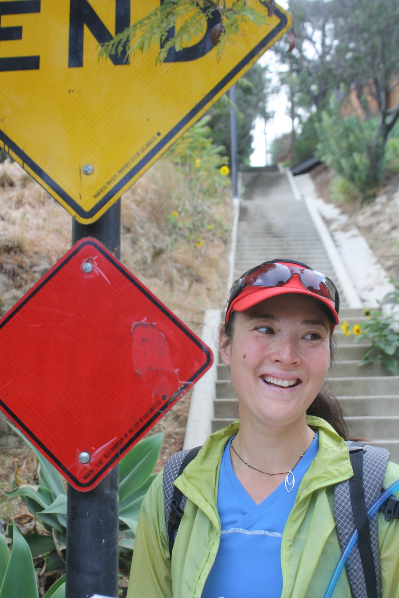
Twenty-seven miles in and looking good—or at least we’re smiling!

Coming into our pit stop was sweet relief—both because it meant we were more than halfway and because of the Christmas-cornucopia of treats it supplied. In that sort of third-person view on oneself that tiredness can provide, I saw myself sitting there on the curb of the parking lot along the Kancamangus Highway, with a half-eaten banana on my knee, shoveling fried rice into my mouth with my hand (I’d forgotten to pre-pack a spoon), taking swigs of my Very Green juice drink in between. I may have looked like a wreck, but I was a wreck refueling. After a few hundred more calories went in, I treated myself to a pair of dry Darn Tough’s, peeling off the mucky Light Hiker Micro Crew’s and feeling the cosiness of a fresh pair.

The rest of the run went by in flashes and blurs of the Northeast’s celebrated autumn paparazzi of color. In yet, for all it’s show of glory, we were it’s only witness. We never saw another soul along the trail. The wild trails of the Pemi interior gave way to the popular Ethan Pond Trail at its edges. Still no souls. Our plotting out of 50 precise miles had required some routing jiggery, and one outcome of that was that our last three miles of this wilderness run would be along the tracks of the scenic train running up to Crawford Notch. While on the one hand train tracks are hardly emblematic of wilderness, on the other, running along those quiet, straight, and graded final miles provided a time for transitioning back to civilization and for pondering what wilderness means to me, fifty years after it was politically defined, and some twenty years after I began exploring its various expanses on the American map.

Photo #5

Entering the colorful flatlands of the Sawyer River Trail

During that exploration, I’ve seen many straightaway paths in my thinking, but switchbacks as well. In those twenty years of Wilderness exploration, I have transtioned from a outdoor neophyte to a person who makes his living and his life in natural places. I still believe in the symbolic and real gesture of wilderness as a place where humanity puts aside it’s claim to the top triangle of the pyramid, puts aside its desperate clinging to scientific rationalism, and says, in effect, “In this place, nature knows best.” In yet, I also realize the attraction that these places hold to those with wild spaces still left within their hearts, and I realize that unless that value is understood by the wider herd, then the resource will ultimately wither: In order to be valued, Wilderness must be encountered. And in order to be saved, Wilderness must be valued…but if too many are encountering it, is it still wilderness?

As I jogged along—OK, maybe now it was more of a fast-walk—thinking about such contradictions and conundrums in my own thought, I by necessity also reflected on some of the contradictions, conundrums, and just plain confounding actions of those we’ve appointed to manage these Wilderness places. They’ve got a tough job. Defining the reasonable boundaries of human activity in a place that is supposed to be wild makes you something of the adult chaperones at a high school homecoming dance. A recent flashpoint in my guiding community has been the issue of placing bolts on the rappel route off of the West Ridge of Forbidden Peak, a “Fifty Classics Climb” in the North Cascades. To put is quickly, this route is in a Wilderness Area and a guide put in bolted rappel anchors on a descent path that was previously riddled with an ugly confetti of rope, webbing, and whatever else. The National Park Service cut those bolts in an unusual display of efficiency and authority and then, not long after, a climber was killed by rockfall while negotiating these confetti anchors (see Rock & Ice’s article HERE for some background and analysis on this specific incident).

Photo #6

Scenes from this summer in the alpine—on the classic wilderness route, West Ridge of Forbidden Peak.

I strongly admire and support the idea that declaring an area as Wilderness is an admirable gesture of restraint among our all-too-ambitious race, but I also believe in consistency of thought and critical reflection in its execution. Speaking generally, one could argue that trails themselves—and maintained trails are prevalent in Wilderness Areas–are evidence of “trammeling”. More particularly with Forbidden Peak, one might wonder how nylon tat—with its goudy array of colors and a UV decay time of somewhere around the current age of the Wilderness Act—is somehow more “natural” and less “impact” than two simple 3/8” cylinders drilled 2” deep into a rock expanse the size of a vertical football field. Particularly when apart from the fauna that inhabit those alpine reaches—who are not in any way affected by the bolts (or the tat, for fairness I have to say)–the only people who might conceivably see those bolts are climbers. And if there are climbers who choose to eschew the bolts in favor of their own “wild” solution, let them express that wildness and leave their own tat mess.

These kinds of contentions and contradictions are evident throughout the history of Wilderness over the past 50 years. Many have struggled individually with the question of what “wilderness” really is and as a society we have struggled with the question of what the value of “Wilderness” is and also the question of who it is that really values—and benefits from—its existence.

Photo #7

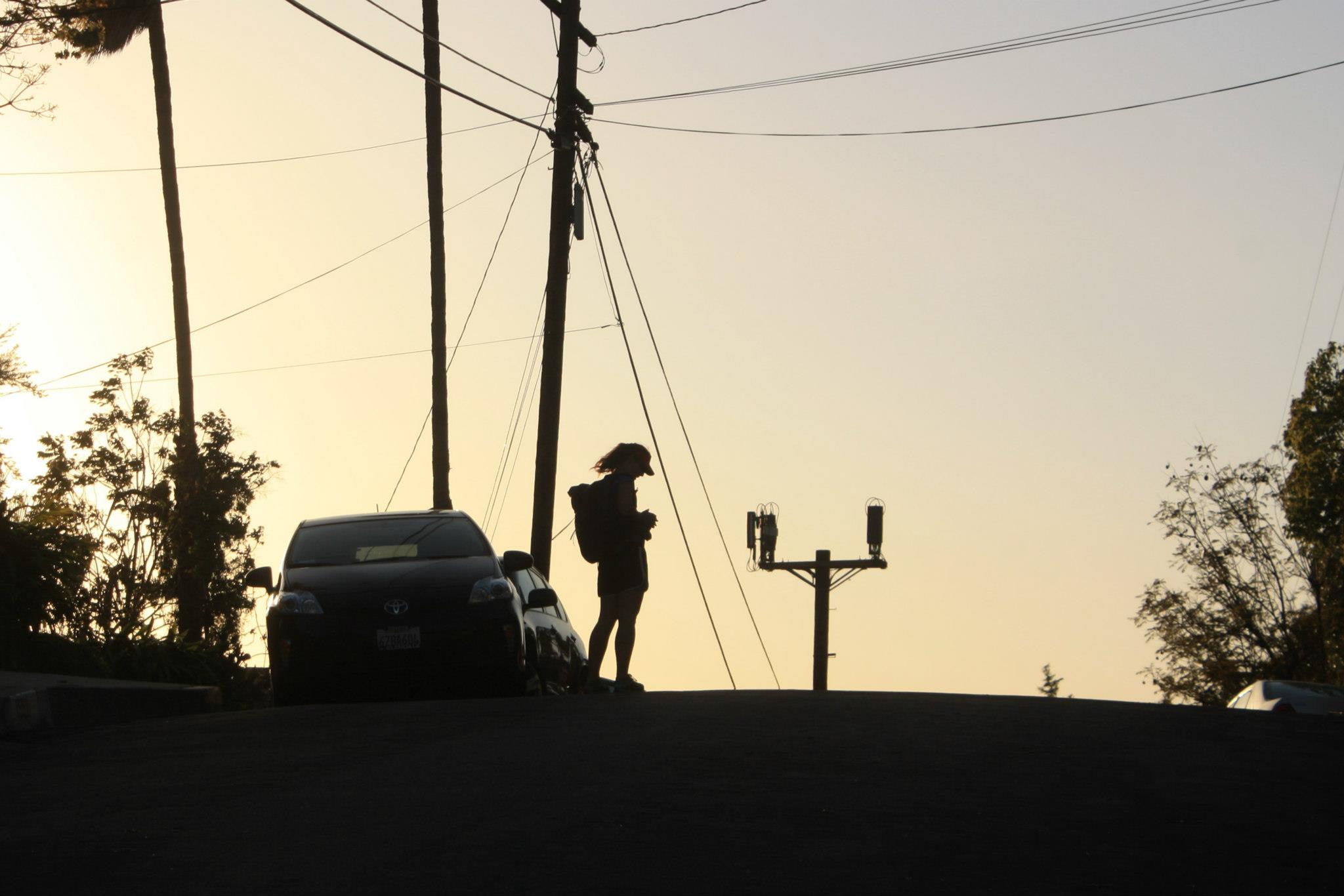
Fifteen miles go until we reach the edge of civilization.

The fact that I was thinking about Wilderness as it pertains to climbing while completing the last three miles of this “50 Miles of Wilderness for 50 Years of Wilderness” run is perhaps telling. In so far as I enjoyed the process of training for the run and the many hours of trail time contemplation it afforded, I am at the root a climber: No walk, hike, or run should begin without an ultimate climb in mind or end without some kind of climb having been accomplished. But whether trail runner at root or climber at the core, it is well worth considering and celebrating the 50th Anniversary of The Wilderness Act, embracing the concept of wilderness in its variety of interpretations, seeking out one’s own definition for it, and joining in that diversity of conversations, and—ultimately and most importantly feeling the sense of wildness in your own bones that wide open, wild spaces can offer.

Photo #8

Untrammeled—and just perfect.

A Trip On The World’s First Urban Long Distance Hike

If you had asked me a month ago what makes a foot-powered adventure a hike instead of just a walk, I would have said “nature.” After my most recent trip, a strenuous 5.5 day traverse of Los Angeles, I’m not so sure.

In April, I undertook what might be the world’s first urban thru-hike—a long distance hike entirely within the confines of a city. Much like a traditional hike, my urban adventure was designed to capture the world at three miles per hours. Despite LA’s reputation as one of the least pedestrian friendly places in the country, when much of it was built in the 20’s and 30’s, its early designers actually privileged those on foot by building public stairways—vertical parks formed into the hills that connect two parallel streets separated by elevation.

Urban art

These stairways are as much a part of LA’s transportation system as its highways. Similar to a mountain trail, a stairhiker goes where the car can never go and give the walker a view the driver will never know.

DowntownLA

LA has more than 300 of these public stairways, which function as upright sidewalks connecting the knolls of the city with the flatlands we usually associate with the metropolis.  Don’t think of LA as hilly? Beverley and Hollywood Hills where the Hollywood sign can be found are some well-known highlands, but the cliffs along the ocean such as Pacific Palisades and Palos Verdes also provide elevation change.

Stairsend

The idea for a long distance stairway hike was conceived by Andrew Lichtman and Ying Chen, LA walking enthusiasts with a long distance hiking background (Ying has thru-hiked the Pacific Crest Trail). The two hikers confronted Bob Inman, guru of LA stairways and author of A Guide to the Public Stairways of Los Angeles, who, on their urging, developed a 180-mile, 300 stairway route traveling across the city dubbed “the Inman 300.” My hike is a hybrid of Bob’s route that also includes a well-traveled course developed by another stairway guru, Dan Koeppel, called “Stairtrek.” If you’re in LA, you should go on Dan or Bob’s free guided walks around the stairs of LA, either Bob’s weekly walks or Dan’s annual Stairtrek or Big Parade trip.

Hoover walk stair mural Liz

The urban walk does have a leg up on mountain walking in some respects. Urban hikers don’t have to carry a tent or sleeping bag (there are plenty of hotels along the way). Restaurants are easily found and hikers don’t have to worry if there will be a water source in the near future. I always knew that if I became injured, that unlike a remote trail, getting help would be easy.

Sunset

The urban hiker’s backpack is a lot smaller than the mountain walker’s. I found sunscreen, sunglasses, and a hat to be musts for urban walking. Since cement is notably harsher on the feet than mountain trails, I’d suggest bringing extra pairs of Darn Tough Vermont socks. When my feet started hurting on this LA hike, I switched out my socks and was astounded how much better they felt. As backup, I carried a little water, food, and a headlamp. In case my phone battery died, I also had a paper map in addition to the street maps on my cell.

Arrow the right way

Urban hiking is a way better way to explore a city than a tour bus. It’s even a fun way to see new neighborhoods and “hidden” corners of your own city. I hope that my stories from the LA route might convince some veteran mountain hikers and even some city folk to strap on a pack and explore places on foot that can’t be reached by car, even if they’re only going on a walk in their own neighborhood.

Liz Thomas
Twitter: @eathomas
Photos: Gilbert Garcia

The Trans Adirondack Route

We recently had a chance to catch up with hiker Erik Schlimmer, who designs sustainable trails for federal, state, and private agencies, to talk about his latest adventure: The Trans Adirondack Route.

Q: How did you get involved?  When was the idea of the route originally thought of and when was it officially established?

ES: The story of the Trans Adirondack Route actually begins in 2005. Up until that year I had done a lot of off-trail travel in the Northeast, and I had hiked a handful of long-distance trails throughout the U.S. I assumed that combining these two pursuits would be a good idea. So in 2005 I planned to traverse the entire Adirondack Park without the use of trails – it was going to be all off-trail. But then, at the last moment, I cancelled this trip. To be honest, it sounded too challenging.

In 2010 I revisited this idea of traversing the Adirondack Park, but this time I planned on using trails. In August of that year I hiked across the entire park by combining paved roads, dirt roads, abandoned paths, hiking trails, snowmobile trails, and a few off-trail sections.

During this hike I had no intention of sharing my route, but when I reached the end, I said to myself, “My goodness, that was a good hike. Others will surely want to hike it.” So I named my route the Trans Adirondack Route, and during the past three years I developed a website, wrote a guidebook, and produced a map set so others could follow my footsteps across the Adirondack Park.

Image

Q: What draws you to this area?

ES: I’ve been exploring the Adirondack Mountains since the 1980’s, and there is still something special about this range. I like its history, the immense portions of trail-less terrain, the size, the environmental protection in place, the quiet, and the mammals. But the wildness is its main draw. For example, of the 500 highest peaks, fewer than 90 have trails to their tops. That’s some wild stuff.

Image

Q: How would you describe the route? Where does it begin and end?

ES: The route is 235 miles long and climbs 25,000 vertical feet from end-to-end, which actually is not a lot of climbing, especially compared to other Northeast long trails. The Trans Adirondack Route begins in Ellenburg Center, N.Y. just nine miles from Canada and ends near the small settlement of Lassellsville, N. Y., which is a half-hour drive from Albany. Some highlights of the route include Whiteface Mountain, the Cold River, the Cedar River, Long Lake, Catamount Mountain, and the High Peaks.

Image

Q: What makes the Trans Adirondack Route different than other trails in the Northeast?

ES: The Trans Adirondack Route is different from other long-distance pathways on several levels. For one thing, since it incorporates sections of abandoned paths and requires some off-trail travel, the route itself is wilder than other standardized long trails. It also traverses the biggest chunks of wild land in the East, including two wilderness areas of nearly 200,000 acres each. Plus the entire route is located in the largest forest preserve in the lower forty-eight. Of course the route is also scenic and visits first growth forest, lakeshores, river valleys, and small settlements.

Image

Q: Do you have an idea of how many people have attempted it?

ES: The route is a newborn, it just debuted in April 2013. With Blue Line to Blue Line: The Official Guide to the Trans Adirondack Route coming out this month, prospective hikers will have what they need to traverse the entire route. A few long-distance hikers have contacted me already, and are anxious to explore this route.

Image

Q: How can people obtain more information about the Trans Adirondack Route?

ES: There are two online sources. On the Trans Adirondack Route website, visitors can purchase merchandise, view photos of the route, visit links, and learn more about the route. At the Trans Adirondack Route Facebook page, visitors can receive updates about the route, get invited to Trans Adirondack Route events, partake in giveaways, and indulge in Adirondack gossip.

Father and Daughter Hikers Balls and Sunshine Conquer the Appalachian Trail, Celebrate Sunshine’s 12th Birthday, and Help Africans Obtain Clean Drinking Water!

What did you do this summer?!

Hitting the Trail

If you’re lucky enough to be in the mountains, then you’re lucky enough.  This makes me the luckiest man alive, because on top of that, I spent the last 4 months in the mountains with my oldest daughter Sunshine!  Sunshine is a very goal-driven young lady and plans to be the youngest Triple Crown Hiker at age 13.  The triple crown of hiking is the Pacific Crest Trail (2,652 miles), the Appalachian Trail (2,184 miles), and the Continental Divide Trail at (3,100 miles). We already hiked the PCT in 2011 and just finished the AT this summer in 113 days.

AT versus PCT

People continue to ask us how the two trails differ, or which we like the most. The first is a tough question; everything is different about the two trails! The PCT passes through much more wilderness lands while the AT has more towns and development nearby. This gives the AT hiker the opportunity to resupply more often and carry less food weight. However, the PCT hiker enjoys more solitude and less distraction from the modern world. The PCT allows horses, which keeps the grade less than 14% while the AT at times can be very rugged and steep. Sunshine tripped and broke her arm on the rocky Pennsylvania tread. However, on the PCT, we had many blisters and one of Sunshine’s became badly infected because of the dusty and dirty (horse poo) trail.  She recovered from both of those setbacks and bravely finished both trails with grace and determination. Both have their rewards and challenges. We love the iconic and historic AT, but as Oregonians, the PCT is home and will always hold a special place in our hearts.

Finding their Stride in Darn Tough Socks

We were privileged to represent Darn Tough Vermont socks this year on the Appalachian Trail. Sunshine and I have hiked many miles now and have tried a lot of socks and footwear systems. We have worn most every hiking and running socks on the market, but have never been satisfied with either performance or longevity. That is until now! We hike between 20-36 miles a day. We just couldn’t find a sock that lasted more than 3 weeks on these long hikes. Some lasted as little as 3 days, and that just isn’t acceptable! We had several blister and rash problems with some particular socks too.

We were introduced to Darn Tough last year late on the PCT. A friend was raving about them and mentioned the unconditional lifetime guarantee. By this time I had almost given up on finding a better sock and these sounded too good to be true. Regretfully, I continued buying more replacement socks of the other brands that were better than some to finish the our first thru-hike.

While planning our 2012 AT hike, I knew more sock research was necessary.  The more I read about Darn Tough the more impressed I became. Soon we ordered our Darn Tough socks and decided to exclusively use them to really give them a fair test. As soon as I pulled them out of the package, I could immediately feel the quality difference. We began to train with them and knew we had finally found our solution to the years of foot problems we experienced.

We hiked all 2,184 miles on the AT with the same few pairs of Darn Tough socks and never once wore a hole through any of them! They managed moisture so well that our feet stayed nice and dry even in the muggy humid areas of the east coast. Our blister problems disappeared all together. Not only did they not wear through, but their overall great performance didn’t diminish a bit. We talked to every hiker on the AT that we met wearing Darn Tough socks, and they all agreed with our findings. They were all excited to talk about their superior performance and longevity. We haven’t met one person yet that has had any complaints. We were bragging them up in an outdoors store along the trail that did not carry them, and the employee was so impressed that he wrote down the web  address to order his own. Remember, this is a guy that gets half off the other brands, but apparently was never satisfied. I’m a pretty skeptical person, but Darn Tough made a believer and lifetime customer out of me.

Hiking For a Purpose

We decided that we wanted this hike to be about something more than just us enjoying another long hike. That is why we joined with the amazing charity Active Water. We are raising money to provide clean drinking water for villages in Zambia, Africa. Thousands die each year from water-born diseases there. We are committed to raising $4362 ($2 for every mile we walked) which is enough for one village well and a few family water filters.  A very generous anonymous person committed to matching all contributions up to our goal! This means we can possibly provide two villages with new wells! Currently, we have raised almost $4,000 including this match. Think of the lives we can save together!  Please see our Active Water page at:
http://www.active.com/donate/activewaterupick/sunshine2012at

For more Details about their AT Thru-Hike:

Balls and Sunshine’s 2012 Appalachian Trail Journal: http://www.trailjournals.com/sunshine2012AT

A Photo Journal of the AT Thru-Hike

Sunshine holding the trail register at the beginning of the AT. We custom made our own signature stamps for signing registers.

The first Blaze at the beginning of the AT.

Sunshine and our good friend Beacon. It actually snowed on us for 3 days in late April.

Sunshine loved the wild ponies at Grayson Highlands on her 12th birthday.

Balls smoked the half gallon challenge at the half-way point. It’s a long-honored tradition that he was not about to break.

We visited NYC for two days. It and DC were two of our favorite breaks.

There were wind gusts up to 73 MPH while we were on Mount Washington in NH.

Balls and Sunshine at the summit of Mt Katahdin, the northern terminus of the AT.

Sunshine was thrilled with her accomplishment of hiking the 2nd of three trails to the triple crown!

Liz “Snorkel” Thomas’ John Muir Trail Thru-Hiking Packing List

Small pack on a high altitude trail

I’m about to head out on the 211-mile long John Muir Trail in the Sierra Nevada mountains of California. It involves a long haul without resupply for more than 100 miles through high, exposed alpine peaks going as far in attitude as 13,100 feet. As usual, I’m not letting the isolation fool me into carrying more weight than I need. Going ultra-lite is about having items in my pack serve multiple uses.

The gear at a glance.

Here’s a quick run down of what is on by back:

Pack and packing materials

Food and hydration:

  • 2-L Platypus hoser (hydration is key to being a happy camper)
  • Sawyer Point One filter plus hose connector
  • Foster’s can pot with soda can windscreen and tin foil “lid”
  • Trail Designs Gram Cracker stove
  • Esbit Tabs (fuel)
  • Bare Boxer bear canister
  • Titanium spork

Clothes

  • Patagonia down sweater and Houdini windshirt
  • Fleece Balaklava
  • Darn Tough Vermont sleeping socks and Gloves (gloves can be potholders)
  • Long sleeve shirt and tights
  • Cuben fiber rain gear
  • 3 pairs of Darn Tough Vermont run/bike ¼ length mesh socks

Sleeping

Other stuff

  • Maps and guidebook
  • Sharpie (mark my stuff with it but also can keep a journal) with Leukotape around it (a medical tape I use instead of moleskin for blisters)
  • Gossamer Gear hiking poles (can also hold up my shelter)
  • First aid kit (Pain killers, anti-diarrhea, anti-histamine, vitamins, anti-itch)
  • Lighter and small matchbook
  • Safety pin (pokes holes into blisters)
  • Bug spray/sunscreen/hand sanitizer
  • Toothbrush/toothpaste

Eastern Bushwhacking: The Challenge of Being a Contrarian

When tackling the most popular peakbagging lists of the East, there are no significant off-trail challenges to speak of.  All but one of the Northeast’s 109 4,000-foot peaks have trails to their summits while in the South the challenge increases only a little: Nine of their 36 6,000-foot peaks do not have trails to their summits, but these off-trail routes rarely exceed a half-mile.

Let the traditional peakbaggers have their trails to their summits.

The peakbagging contrarians who greatly expand their lists by lowering the cutoff elevation – pursuing the Northeast’s 770 3,000-footers or the South’s 198 5,000-footers, for examples – are forced to take a walk on the wild side by bushwhacking up scores of trailless peaks.  Anyone who has completed one of these expanded lists probably has more war stories than a World War II veteran.  Tales of struggling through stunted forests, crawling under blowdown, and fighting through briar fields are commonplace.  And the storytellers rarely embellish for a simple reason: They don’t have to.  Off-trail travel in the East is exciting enough as nonfiction.

Schlimmer on trailless 5,380-foot Sugarland Mountain, Southeast

What follows are, in no particular order, the ten most challenging characteristics of Eastern off-trail travel.  Fittingly, below that descriptive list are the ten most important things to do while traveling through the “thick of it.”

The challenges

  • Blowdown: Born in the Northeast from windstorms and in the South from invasive species that kill trees, these toppled forests can be stacked up to ten feet high and cover acres of ground.

Blowdown and spruce, Northeast

  • Spruce thickets: Pushing through these dense forests is like pushing through a carwash that scrubs your car with wire brushes instead of cloths.

Pushing through a spruce thicket, Northeast

  • Cliffs: These can be spotted and evaded while ascending, but by the time you encounter them while descending, it is too late.  You’ll have to climb back up and attempt to descend another way.
  • Swamps: There are thousands of these to skirt in the Northeast.  Swamps also serve as breeding grounds for billions of biting insects.
  • Obscurity: The sub-4,000-foot peaks of the Northeast and sub-6,000-foot peaks of the South get no press in guidebooks or online.  These mountains are terra incognita.

Dense second-growth hardwood forest, Northeast

  • Scree fields: Found mostly in the Northeast, these boulder fields are composed of microwave- to couch-sized rocks, many of them unstable.
  • Remoteness: In the Northeast, obscure peaks are approached via long, desolate dirt roads where you might get crushed by a speeding logging truck.  Some Southern peaks in Great Smoky Mountains National Park require up to twenty miles of hiking.

Traveling through recovering clear cut, Northeast

  • Winter: It gets cold down South, but surely nothing like the Northeast.  If tackling Northeast peaks year-round, be prepared for subzero temperatures, biting wind, and deep snow.

Deep snow burying blowdown and spruce, Northeast

  • Rhododendron thickets: The antithesis of Southern hospitality, these thickets, sometimes dubbed “hells,” may be too dense to penetrate via hiking.  Crawling on your hands and knees on wild hog paths may be your only option.

Beginning of rhododendron “hell,” Southeast

  • Briars: There is nothing quite like thrashing through acres of briars while wearing a long sleeve shirt and work pants when it is 80 degrees out… thank goodness.

Wall of briars, Southeast

Do it

  • Carry two maps:  Losing your only map while in a trailless wilderness is like losing your paddle on You-Know-What Creek.  Carry one map in your pocket and another in your pack.
  • Tell someone where you are going: To be honest, they possibly won’t ever find you, but they’ll at least know where to try to find you.
  •  Wear long pants: No matter how hot it is, just do it.
  •  Know how to use a compass: Don’t rely on global positioning systems, which can break or die.  Compasses are sturdy instruments that are rarely unreliable.  Like maps, carry two of them.
  •  Know how to find direction by using the sun: A backup to your compass, sometimes you can navigate wholly by the sun, which is a valuable, rewarding skill.
  • Be in great shape: Bushwhacking is tough business for tough people.  As a general rule, five miles of bushwhacking feels like ten miles of trail hiking.
  • Carry communications: When traveling solo, it is a good idea to be able to reach emergency personnel if you become injured.
  • One peak at a time: Remember why you are out there – to go where few have gone and to see things few have seen.  Also, when tackling a list that is hundreds of peaks deep, your goal can seem too far away; nearly unobtainable and more discouraging than exciting.
  • Be prepared to spend the night: Always bring extra clothing, rain gear, headlamp, tarp, fire starter, and extra food in case you’re caught by sundown.
  • Have style: Since you are being bold by going off-trail, be bolder and pick routes that are rarely climbed, are more remote than others, or offer dramatic scenery.  You’ll thank yourself later.

By Erik Schlimmer

– Erik Schlimmer completed the Northeast’s 770 3,000-footers in 2004 and is three peaks shy of completing the South’s 198 5,000-footers.  More on his adventures can be found at erikschlimmer.com

2,184.2 Miles of Single Track: The Run Bum Embarks on his AT Record Attempt

The Run Bum, Sean Blanton, taking a quick break during a 20 mile run/hike from the Golden Gate Bridge to Muir Beach and back.

Darn Tough Vermont: So what exactly are you trying to do?

Run Bum: My goal is to break the current Appalachian Trail speed record this year. I have to rephrase that Denise and myself’s goal is to break the record. Denise is my crew chief. Its just me and her. She is the ONLY reason I am able to give this thing a shot. Thank you Denise.

According to the Awol Guide the Appalachian Trail is now 2,184.2 miles long for 2012. Each year diversions etc add a bit of distance to it. Just like Everest grows taller each year the AT grows longer. So the easiest time to do it is now. Not when you cash in your 401k.

For me as a member of the La Sportiva Mountain running team, as you can imagine my favorite thing in the world is running mountain trails. Specifically single track I have never run before. The Appalachian Trail offers me this in a close to unlimited amount.

I have never been a hiker. I was never a runner until some 4 years ago. In fact I thought runners were stupid. Now I stand to be both. It’s funny where life will take you if you let it. Don’t fight adventure just fight yourself telling you to slow down.

DTV: How did this come to be?

RB: It was last year that I went on a trek, or hike as we call it, in the Everest Region of Nepal. The reason I was even over there was to run the Everest Ultra Marathon, the world’s highest ultra. Although the day before I left I got an email that said the race was canceled. “ARE YOU SERIOUS!?!?!?!,” I yelled at my computer. I couldn’t believe it. I had paid for my ticket, arranged my trek to the start and planned a bunch of awesome stuff to do during my 40-day stay in Nepal.

I got to Nepal slightly disappointed about the race. My plan was to do the race course anyways. I met up with the 3 other people I had met on a travel website. We had planned a 25 day trek in the Everest Region. After we all met up in Kathmandu, the capital of Nepal, we flew out to Lukla. Lukla is the gateway to Everest. 99% of treks to Everest base camp start here.

I remember being in great shape for running and ultras. I however was not ready for what was about to happen to me. Every day of our trek we crept higher and higher. It it was just straight up it would not have been that bad. It was up and down and up and down. Even our “rest days” would involved thousands of feet of elevation change. Every day the first 7 days I woke up in awful pain. My quads and calves were toast! Everyday was relentless 8 hours of hiking a day up and down these crazy Himalayan mountains. This alone was tough then, add in the 10,000-19,000 feet above sea level that we were at for 3 weeks and you’re hurting!

After about 8 days of agony something happened. I woke up not sore at all. My body had adapted. The rest of the trip I pushed harder with more up and more pounding down hill. Still I wasn’t getting sore.

At the end of the trip I ditched my idea of the Everest Ultra course for a crazier run. Lukla to Jiri. Some 50+ miles with some 60,000 ft of elevation change. The goal was to do this in one day. The local sherpas said that it was not possible. This fueled me more.

I took off at 3 am from Lukla on a unfamiliar trail in the dark thick fog. I got lost. Very lost. Being lost in a 3rd world country on trails you don’t know by yourself is kind of scary. I kept my cool and eventually got back on course after about 3 hours.
This trail was insane. Rocky as heck and just up and down. There was one 6,000 + ft climb. Each climb was at least 2,000 ft and just went on forever. I ran/hiked for over 12 hours that day stopping to eat in tea houses with my 35 lb pack on my back. I had to stop shy that day since I got lost earlier.

I figured the next day I would be crippled. Not even sore. The himalayas and trekking for some 20+ days had turned me into a beast. I couldn’t run fast but I could run/hike forever. Another 12 hours that day and I was done.

It was then and there that I knew I could take down the Appalachian Trail.

I had experienced my body adapting to the brutality of hiking and running for the great part of the day day in and day out. I have found that my body recovers really fast from ultras. People tell me it must be nice to be young all the time. I think that is garbage. It is because my body never gets a chance to fully rest. I am always running or doing something active everyday. I referee sports 7 days a week in turn with running, soccer and hiking. PS I hate reffing sports. Turns out people get mad at the ref… A LOT!

I also realized that the distances I was covering would smash the current record pace. I figured that could set my goal at 50 miles per day. At the time I had not heard of Jenn Pharr Davis attempting the trail again. I knew of Andrew’s goal of 47 days and change. My goal was not to beat this but to shatter. I wanted to try and redefine what people called endurance, redefine what it meant to give it your all and I wanted to raise money for The American Cancer Society. Before Everest I had read David Horton’s book about him running the AT. It really inspired me. He actually RAN it. I had planned to run/hike it.

DTV: Did anything in particular inspire you to do this?

RB: I’d have to lie if I said Dean Karnaze’s book “Ultramarathon Man” didn’t inspire the charity runs I’ve done. I think his and my quest for something longer and greater are very much alike. I think the biggest inspiration for me are my family and friends. My dad always jokes with me when I go run road marathons, “Oh just a marathon? Did you at least run home afterwards?” I love it. As do most ultra marathon runners, we tend to try and do the craziest things possible and then act like we aren’t phased by the pain. I’m sure you could shoot and/or stab most ultra runners and they would still finish the run. Why? Because it makes for a cool story and that feeling you get from doing something that difficult.

I recall reading in some Facebook post something along the lines of “ SHE’S DONE IT! SHE BROKE THE RECORD!” This was in reference to Jenn Pharr Davis breaking the AT record. I knew I had my work cut out for me. But because she was a women it made such huge news. I now knew everyone was going to be thinking that I was setting off to break her record or that I saw her do it and so now I wanted to do it. This is not true. I actually emailed David Horton, who never emailed me back. He never emailed me back because he was in the middle of crewing Jenn. I am sure he thought I was another glory chaser. Really I had been inspired in part by his book. I also remember a couple of years back when Karl Meltzer did it. I remember following that. The guy got trench foot and kept running. He experienced horrible luck with weather. I would try and learn from what they had done. I figured that Karl ran most of it and Jenn hiked all of it. I would try to meet that in the middle. I look to Jenn and Karl as an inspiration. Both of them are amazing. Speed goat Karl has been helping answer a lot of my (most likely) silly questions. So again this is not about who set the record its just someone set the bar and I plan to jump over that bar. Records are meant to be broken. No one sets a record that stands forever. It’s the nature of the beast. That is why I don’t plan on trying to better the current record by a day or two. I want something that stands the test of time.

Unlike Karl and Jenn I am headed north bound. This is a lot harder. I will be chasing warm weather and more daylight northwards. Everyone has said that New Hampshire and Vermont are the hardest areas. Specifically the Green and White Mountains. For others they have liked to start with the hard part at the beginning. I’d rather finish with that. A record has never been set northbound. I like to think of it like this. Nothing has been done until someone does it. It is what it is. Running “uphill” as they say.

I am making a gamble that Baxter State Park in Maine, where the finish atop Mt. Katahdin lays, will be open. So far so good but if we get any late season snow I could be out of luck.

Enjoying the sunset at 9,000 feet up on Haleakala, a 10,000 ft mountain volcano on Maui. Taken while training in Hawaii for three weeks.

DTV: Do you have any fears or concerns?

RB: I am worried people will surely misinterpret what I am trying to accomplish.
The trail is a beautiful thing. I hear a lot of hikers and people telling me that running that much a day and going for a record is against the trail code. They call it stupid or put me down. They try to make me feel bad about going fast. My thing is this. Speed is relative; fun is not. The trail is there for everyone to enjoy in their own way so long as they don’t take away from others. This is how I enjoy the trail. My personality can not take going at a hiking pace. I don’t need to speed hours at a vista or a lake to enjoy it. I am a “see all, do all in one day” kinda of guy. I mean, to each his own right? Also there are no rules on the trail. No one can tell you this is what you have to do. I am a hiker, a runner and an adventurer. I only have 40 something days for this so Ill go with what I’ve been given.

DTV: What’s your goal?

RB: To raise as much money for the American Cancer Society as possible. I think that by going for a record more people will give and my outreach will be greater.

I also like to help the trail by picking up any trash I see. It makes me sad that people can not see beyond what they do and their way of doing it. If everyone did everything the same way all around the world we would accomplish nothing. There would be no great poets, no great novels, no new music, no good tunes. It would be the death of everything creative in the world.

DTV: Does anything scare you out on the trail?

RB: There are crazies out there like everywhere else in the world. But for the most part it’s not the hikers but random intruders on the trail. Everyone I ever meet hiking or running is amazing. Everyone their own story. I love it. 2,184.2 miles of smiles. I will however be packing heat just in case.

Then you also have to worry about blisters, chafing, dehydration, hyponatrimia, over heating, hypothermia, falling, stress fractures, muscle pulls and strains, rashes, snakes, spiders, ticks, bears, flies, bees, hornets, bacteria, parasites, diarrhea, and vomiting to name a few. Oh yea and my body is going to hate me for trying to be on my feet running or hiking for 15+ hrs a day!

Blisters are inevitable but with the help of a bunch of the world’s toughest socks, Darn Tough Vermont socks, my feet will see less of them and hold up to the trail.

I think, however, my biggest concern of all is keeping enough calories in me so I don’t drop too much weight. I will have to consume some 8,000 calories a day to maintain my current weight. I want you to go look at something you’re eating for lunch or dinner. Look at how many calories it has then figure out how many of those you would need to consume to get 8,000 calories. IT’S A LOT! Now try to eat that all while still moving forward up and over uneven mountain trails. Thankfully Clif has donated some 25 boxes of Clif products to aid me along the way.

For me it’s not about the record, its about adventure and inspiring people. I hope that I can go out there and entertain people while I put myself through hell. I want people to be so inspired they donate money to the American Cancer Society. I know that no matter how much pain I am in that it is nothing compared to the pain of cancer and those who’ve been touched by cancer. I think if I did not run for a cause then I would be selfish. It’s about running for those who can and inspiring those who can to do the same.

If you ask anyone who knows me they will tell you my motto. Run for fun and you always win. I always run for fun. For me it’s not about 1st or last its about the journey. For all the races I am at my goal is to have fun. Although sometimes that fun is winning, I will admit.

DTV: Why the Appalachian Trail? Why not the PCT or CDT or something else?

RB: I am born and raised in Atlanta, Georgia. The AT starts in my back yard. Well 2 hours north of my actual backyard. I’ve had a bunch of friends thru hike before and tell me all the crazy stories. I seek adventure every day and this seemed like the ultimate adventure. I train on and around the AT near Blood Mountain. I always start down the AT feeling good. I just keep going and going but then I have to stop myself. I realize I can’t run to the end of the trail in a day like all the other trails around here. This fact really peaks my curiosity. Where does it go? I want to follow the trail until it ends. I want to find the pot of gold at the end of the rainbow.

The AT will be a life changing event for me I know this. Though one can never really fully prepare for it.

DTV: So then, what’s your strategy?

RB: This is simple. My strategy is to ADAPT. I will adapt to whatever conditions are thrown at me. If its too hot during the day Ill go at night. After all, Petzl sent me some really bright NAO/MYO RXP headlamps!

If I am not getting 50 miles in 15 hours then I’ll go longer. If my feet get so messed up I can’t continue, Ill use duct tape and keep going. I will adapt to whatever I need to be to do this.

I guess this comes back to the word endurance. People misuse this as a word for stamina. This is not true. Just look at the word. ENDURance. The ability to endure. I plan to endure what the trail and mother nature has to throw at me. I want to redefine what people see as endurance.

My goal is to be smiling more than frowning. After all the point of this is to have fun. I hope I can inspire people to get out and run, hike, donate, and inspire others to do the same.

DTV: How can we follow your progress?

RB: To follow my progress along the AT go to www.RunBum.com and like our Facebook page.

DTV: Any last words?

RB: I just hope people understand me as a nice guy who is trying to do the trail in my own way and raise money for a good cause while doing it.

I have to say that this would not be possible without my family, friends, La Sportiva, Cliff Bar, Petzl, Publix, Mix1, Break Through Nutrition, Darn Tough Vermont Socks, Headsweats and RunBum.com

Sunshine and Balls Countdown to the AT Thru-Hike

Winter flew by at warp speed. It seems like only last week that we were coming home from our epic PCT journey. We will begin our new journey on the Appalachian Trail in only days now.

Sunshine emearced herself in school and violin. She earned a 4.0 GPA this winter, so no one at her school objected to her leaving early to hike again. Her Math teacher is sending worksheets to work on while on the trail. I was offered my most recent job back upon our return from the PCT. I have been working hard including weekends to save up for our AT hike.

Sunshine with some favorite "trail food"

Teresa is finishing up her Masters Degree so she has been working as an intern teacher by day and goes to class in the evenings. Most of her weekends are consumed by homework. Sunshine and Butterfly have been helping with the house work.

We have begun training, but because of our schedules, we have not trained nearly as much as we intended. We are both physically fit so really the only thing we need to condition is our feet.

OPB aired our Oregon Field Guide episode on Thursday March 22nd. It is all about our 2011 PCT hike. If you missed it or are not in Oregon, you can see it at: http://www.opb.org/programs/ofg/

We have all our resupply boxes packed and are beginning to put our gear together. I laundered all our hiking clothes last night and I was excited to see our Darn Tough socks again.  Sunshine has already worn them for 2 weeks of training and school. She has very sensitive skin (you know red heads) and we are pleased to know that they performed better than any other sock in the past with no skin reactions. They really are beautiful works of art, especially the Women’s socks.

Sunshine's new tent by Six Moon Designs doubles as a poncho.

We fly out of Portland on the 31st of March. We have a great friend picking us up at the airport and driving us to the trail. Others already on the trail are reporting warm weather with lots of bugs!

We plan to blog here periodically, but will be journaling daily on: www.trailjournals.com/sunshine2012at

Also, we are helping the non-profit ActiveWater raise money for clean drinking water in Zambia, Africa. We committed to raising $2 per mile we hike, for a total of $4334.  This will provide one clean drinking-water well and several home water filters. So far, we aren’t doing very well with achieving this goal. Please go to: www.active.com/donate/activewaterupick/sunshine2012at
and consider what you can do to help us change/save lives. We want our hike to be about something greater than ourselves this year.

Thank you,

-Balls and Sunshine

The Ridiculousness That Is Thru-Hiking

I used to joke with people whenever I was asked the question “Aren’t you worried about crazy people while you’re out there in the woods for months at a time?  “My response was always “Are you serious? I’m going to go hike a few thousand miles with nothing more than what I have on my back.  I am the crazy person!”   Now I wonder if my joke had a little bit more truth to it than I thought.

Chris "Chance" DePolo

My last trip of 2,700 miles down the Continental Divide Trail from Canada to Mexico through Montana, Idaho, Wyoming, Colorado, and New Mexico really broke me down and made me rethink my thru-hiking philosophies.  Just so we are clear I consider thru-hiking and hiking to be very very very different things with very different philosophies.

Hiking is casual and leisurely, you usually have a schedule, you have a destination, you know when you’ll be home, when you will be warm and dry again, you know that you can go cook yourself a warm meal…on a stove…in a kitchen…under a roof, you know that in the near future you will be sleeping in a bed, and you know that (at least if you are smart about it) people know where you are. Since you have a destination and a schedule you probably carry luxuries, maybe a coffee press, a frying pan, tasty food, warm clothes, dry clothes, extra clothes (PS these are all the things I miss if you hadn’t guessed), extra food, and maybe a good beer or liquor.  You also aren’t hiking from sunup to sundown.  You probably chose your campsites before you even started your hike so you have a set mileage per day and you know when you get there you can stop, take a load off, setup camp, and relax.  Who knows, maybe you even have a campfire and cook s’mores!

As a thru-hiker you have a destination (but it’s so far off that you try not to think about it), your schedule is almost nonexistent and based only upon the good graces of mother nature and the amount of food in your backpack, you don’t necessarily know when you will be warm or dry again (or when you won’t be sweating and concerned about water if it’s the desert), you’re not sure when you’ll be done or even if you will make it, and unless you’re carrying a personal locator beacon or have just recently checked with someone there is a good chance that only other hikers (if there happen to be any) know where you are at.

You don’t carry much more than a shelter (maybe just a 5′ x 8′ tarp with no bug netting), a backpack (smaller than you can imagine), a sleeping pad (some uncomfortable super ultralight aka UL foam thing), a sleeping bag (that’s your warm layer), about two pounds of food for each day on your however many day stretch, and just enough (or maybe not enough) water to get you to the next water source.  You probably have one extra pair of socks, but certainly not an extra pair of clothes.  Depending on the terrain and location you may or may not have bothered with rain gear.  If it isn’t likely to rain more than a few days out of a 700 mile desert stretch in Southern California then why bother right?

Maybe you carry a UL alcohol or wood burning stove but if you do chances are you don’t do more than boil water with it.  If you’re really into the UL scene you probably don’t even bother with a stove.  After all it’s not food you’re eating, just fuel for the fire.

The saying goes something like “the more I carry the more I like camping, the less I carry the more I like hiking” and we thru-hikers have really taken that to the extreme.  You obviously don’t wear boots and probably haven’t in longer than you can remember.  When it snows you put on your warmest socks and just accept the fact that your feet are going to be wet and probably cold.  You probably just crossed a stream full of snow-melt runoff so what good would boots do anyways.

All of the above probably sounds a bit ridiculous to you right?  It sounds absolutely ridiculous to me too right now, but that’s just because I’m sitting here with the luxuries of a place I like to call Home.

You know when it didn’t sound absolutely ridiculous?  When I was climbing up and hiking along the Continental Divide Trail anywhere from 11,000 to 14,000 feet through Colorado.  I felt every single ounce and every single little minuscule gram in my pack as I was gasping for air that just didn’t hold enough oxygen for me to catch my breath.

Am I crazy?  Maybe a little bit.  Would I do it all over again?  In a heartbeat…

-Chris “Chance” DePolo

Sunshine and Balls: A Thru-Hiking Family

I love long distance backpacking!  I hiked the entire Pacific Crest Trail (2,652 miles) in sections between 2002 to 2010.  I only had one problem.  I was having a hard time finding other people who wanted to hike 20 plus miles a day in the usually rainy North West weather.

Both my daughters have gone backpacking with the family since they were babies.  I noticed that my oldest particularly thrived on it.  By the time she was 4, she carried her own gear and would ask me to make the trip longer each time because she wanted to beat her own distance record.  I knew early on that she would someday be my long distance hiking partner.

She was always asking to thru-hike the PCT with me for as long as I can remember.  Thru-hiking is defined as hiking a long trail completely in one continuous trip. I agreed to put our financial affairs in order so we would be ready by the time she graduated from high school.

With some painful twists of fate and a bad economy, our door of opportunity was opened 7 years early.  After loosing my job of 17 years, I came home suppressing the tears and said “I have great news Reed, we’re thru-hiking the PCT this year”!

Sunshine (Reed’s trail name) and I started on the Mexican border April 29th, 4 days before her 11th birthday.  As many as 600 people started the trail that spring, Sunshine of course being the youngest by many years.  We had perfect cool weather conditions in the desert, but the snow level in the Sierra Mountains was the highest on record.  We hiked over 500 miles in Central California through snow, ice, and water crossings.  The warm dry weather held out through all of Oregon and most of Washington.  It only rained on us 3 days in Washington and it began to snow the last 1/2 hour of our final day. We arrived to Canada in just under 5 months.

It was by far the toughest year on record and fewer than 100 thru-hikers completed the trail.  

Sunshine and Balls at the end of the Pacific Crest Trail (PCT)

Sunshine continues to be very goal driven and plans to complete the triple crown of hiking (PCT 2,652 miles, AT 2,100 miles, and CDT 3,100 miles).  As long as she desires this dream, I am committed to helping her achieve it, putting my life and career on hold for now.

We are very proud to represent Darn Tough Socks this year, and excited to use their superior products.  We used 3 different brands of socks last year, but none of them lasted.  Some wore out in as little as 3 days of use.  Sunshine had an allergic reaction to one brand that gave her an extremely painful rash.

We are starting the Appalachian trail on April 1st of this year.  Please follow along as I plan to periodically update readers on this site and blog daily on Trailjournals.com/sunshine2012at throughout our journey.

-Balls and Sunshine